⚠️ Waters Keep Rising: Britain Struggles Under an Unrelenting Chain of Storms 🌊
The rain did not arrive with a single dramatic crash of thunder. It crept in. It lingered. And then it stayed.
Across parts of the United Kingdom, residents first described it as “another wet week.” That phrase now feels painfully inadequate.
What began as a series of Atlantic systems brushing against the western coastline has evolved into something meteorologists are struggling to summarize in ordinary language.
Internally, some forecasters have used a term that sounds almost mechanical: a “storm train.” System after system, lined up over the ocean, each one feeding the next, each one dragging bands of relentless rain across already saturated ground.
And according to the latest briefings, this train shows no sign of switching tracks.
The most unsettling detail is not the rainfall totals—though they are extraordinary in places—nor even the swelling rivers that have burst their banks.
It is the pattern itself.
High above the North Atlantic, the atmospheric steering currents appear locked.
A stubborn jet stream configuration is funneling low-pressure systems toward Britain with unnerving consistency.
The conveyor belt continues.
And with each new arrival, the margin for recovery shrinks.
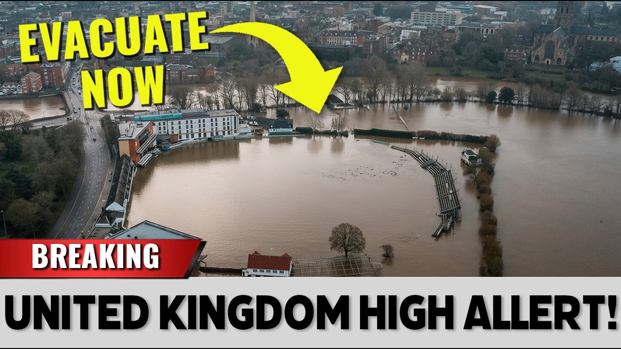
In towns along river valleys, water rose quietly at first.
Garden fences disappeared.
Cars became half-submerged monuments in driveways.
Then entire streets began to resemble canals.
In some communities, the sound of rain hitting rooftops has become constant, a drumming presence that follows residents into uneasy sleep.
Emergency crews have carried children through waist-deep water under streetlights that flicker against the mist.
Sandbags stack up like defensive walls in front of shopfronts, though few believe they are enough.
Officials have tried to strike a measured tone in public statements.
They speak of “unsettled conditions” and “further rainfall expected.” But in closed-door briefings, the language is more direct.
The soil in many regions is already saturated to capacity.
There is nowhere left for the water to go.
Even moderate additional rainfall now triggers rapid runoff.
Rivers that would once have absorbed a few days of steady showers now respond with alarming speed.
Flood alerts have multiplied across counties that rarely see such warnings.
Some residents say the atmosphere itself feels different.
Heavy.
Pressed low over rooftops.
It is not only the physical water that weighs on communities, but the uncertainty.
Each forecast update carries a question mark.
Meteorologists point to ensemble models, to probability bands, to shifting pressure gradients.
Yet the overall message remains disturbingly consistent: more rain is likely.
Perhaps a brief lull.
Then another surge.
The phrase “won’t turn off” has circulated widely in recent days.

It was not intended to be dramatic.
It was meant as a technical description of a persistent synoptic setup.
But once those words left the forecasting room and entered headlines, they struck a nerve.
For many, it felt like confirmation of a fear that had already taken root.
If the mechanism driving this sequence of storms remains locked in place, what exactly would it take to break it?
Climate researchers caution against attributing any single event directly to long-term trends.
Weather, they remind us, is complex and multifaceted.
Yet they also acknowledge that a warmer atmosphere holds more moisture.
When conditions align to produce rain, that rain can be heavier, more intense.
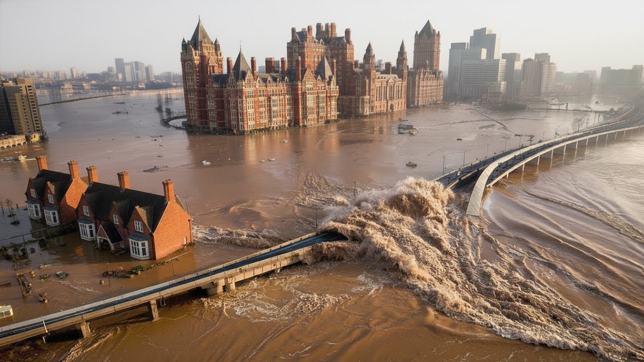
The debate is nuanced, but the images on the ground are stark: rivers spilling across roads, farmland transformed into shallow lakes, railway lines suspended above brown torrents.
In one Midlands town, an elderly resident stood at her upstairs window watching water lap against the first-floor brickwork of a neighbor’s home.
She described the scene as “quietly terrifying.” No roaring waves, no crashing debris.
Just the slow, methodical rise of water inching higher with each pᴀssing hour.
It is that slowness that unsettles people most.
A storm that strikes and moves on leaves damage, yes—but also closure.
This sequence offers neither.
Insurance helplines report a surge in calls.
Businesses that reopened after previous flooding now face renewed closures.
Some shop owners have begun moving stock to upper floors preemptively, not waiting for official evacuation orders.
Schools in several districts have shifted to remote learning as access roads become impᴀssable.
And still the radar screens glow with incoming bands of rain stretching back over the Atlantic horizon.
There are whispers, too, about infrastructure strain.
Drainage systems designed decades ago are under pressure.
Temporary flood defenses, deployed repeatedly over recent seasons, show signs of wear.
Engineers speak cautiously about “thresholds.” How many consecutive high-water events can levees endure before weaknesses emerge? The public rarely hears these conversations, but they hum beneath the surface of every emergency planning meeting.
Perhaps most unnerving is the unpredictability of local impact.
Two towns separated by only a few miles can experience vastly different outcomes depending on river catchments, topography, and ground composition.
A narrow valley can amplify runoff.
A blocked culvert can redirect flow into residential streets.
The maps show lines and colors, but on the ground, the boundaries blur.
And yet, amid the anxiety, life continues in fragmented form.
Volunteers distribute H๏τ drinks in community centers converted into temporary shelters.
Neighbors check on one another.
Social media feeds fill with images of submerged parks and stranded vehicles, accompanied by dark humor and resilience in equal measure.
There is a sense of shared endurance, but also of fatigue.
The psychological toll of waiting for the next alert cannot be measured in millimeters.
Meteorologists are careful not to frame the situation as apocalyptic.
They emphasize that storm tracks can shift.
Blocking patterns can weaken.
A change in upper-level winds could redirect the conveyor belt elsewhere.
But such changes have not yet materialized in a sustained way.
Each new model run offers hope of a break, only for the next update to reintroduce bands of heavy precipitation.
Behind the science lies a more human question: what does it mean for a nation to feel under siege by its own weather? Britain is no stranger to rain.
It is woven into the cultural fabric.
Yet this feels different to many residents—not because rain is falling, but because it refuses to relent.
The rhythm of recovery has been disrupted.
Clean-up efforts are interrupted by fresh inundation.
Repairs are postponed as forecasts hint at renewed flooding.
In coastal areas, high tides compound river discharge, slowing drainage and prolonging flood conditions.
In upland regions, streams cascade with unusual force, carrying debris downstream.
Emergency planners juggle variables that shift by the hour.
A slight change in wind direction, a marginal increase in rainfall intensity, can tip a community from manageable nuisance into crisis.
Critics argue that stronger long-term investment in flood defenses could mitigate such events.
Others counter that no infrastructure can fully eliminate risk under extreme conditions.
The debate is likely to intensify as the rain continues.
But for families stacking sandbags in dimly lit streets, policy arguments feel distant.
Immediate survival and protection take precedence.
There is also the lingering question of what comes after.
Prolonged saturation weakens building foundations.
Mold spreads in damp interiors.
Agricultural losses accumulate.
Even if skies clear tomorrow, the aftermath will stretch on for months.
Recovery, in many cases, will be measured not in days but in seasons.
Late at night, when rainfall eases to a steady whisper rather than a pounding drum, some residents dare to hope the worst has pᴀssed.
They check river gauges online.
They watch the numbers fluctuate.
Sometimes they fall slightly, offering a fragile sense of relief.
Then another system approaches from the southwest, its cloud tops glowing on satellite imagery like an advancing curtain.
No single storm has defined this period.
That may be the most haunting aspect.
There is no singular name to ᴀssign, no one day to circle on a calendar.
Instead, there is an accumulation—a stacking of systems, a layering of impact.
A train of storms, each carriage laden with rain, rolling across the same landscape again and again.
Whether the atmospheric configuration will finally unlock remains uncertain.
Forecast charts extend several days ahead, showing hints of change, then reᴀsserting the familiar pattern.
Experts avoid definitive language.
They have learned that the sky resists absolutes.
For now, communities brace.
Pumps hum.
Sirens cut through damp air.
And above it all, the clouds gather once more over the Atlantic, ᴀssembling in quiet formation.
The mechanism driving them forward remains in motion.
The train continues down its track, and the question that lingers over flooded streets and anxious households alike is simple, yet heavy with implication: when—and how—does it finally stop?


